


Jackson Voting District, Texas County, Missouri
About
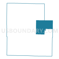
Outline

Summary
| Unique Area Identifier | 611484 |
| Name | Jackson Voting District |
| County | Texas County |
| State | Missouri |
| Area (square miles) | 96.93 |
| Land Area (square miles) | 96.93 |
| Water Area (square miles) | 0.00 |
| % of Land Area | 100.00 |
| % of Water Area | 0.00 |
| Latitude of the Internal Point | 37.36758270 |
| Longtitude of the Internal Point | -91.76702310 |
Maps


Graphs
Select a template below for downloading or customizing gragh for Jackson Voting District, Texas County, Missouri


Neighbors
Neighoring Voting District (by Name) Neighboring Voting District on the Map
- Current Voting District, Texas County, MO
- Lynch No. 2 Voting District, Texas County, MO
- Ozark Voting District, Texas County, MO
- Piney Voting District, Texas County, MO
- R-2, Dent County, MO
- Sherrill Voting District, Texas County, MO
- Spring Valley Voting District, Shannon County, MO
Top 10 Neighboring County Subdivision (by Population) Neighboring County Subdivision on the Map
- Sherrill township, Texas County, MO (5,608)
- Piney township, Texas County, MO (4,770)
- Lynch township, Texas County, MO (1,463)
- Jackson township, Texas County, MO (1,233)
- Spring Valley township, Shannon County, MO (965)
- Ozark township, Texas County, MO (476)
- Current township, Dent County, MO (447)
- Current township, Texas County, MO (294)
Top 10 Neighboring Place (by Population) Neighboring Place on the Map
Top 10 Neighboring Elementary School District (by Population) Neighboring Elementary School District on the Map
Top 10 Neighboring Unified School District (by Population) Neighboring Unified School District on the Map
- Licking School District, MO (6,662)
- Houston R-I School District, MO (5,908)
- Summersville R-II School District, MO (3,058)
Top 10 Neighboring State Legislative District Lower Chamber (by Population) Neighboring State Legislative District Lower Chamber on the Map
- State House District 147, MO (38,962)
- State House District 150, MO (36,107)
- State House District 152, MO (34,200)
Top 10 Neighboring State Legislative District Upper Chamber (by Population) Neighboring State Legislative District Upper Chamber on the Map
Top 10 Neighboring 111th Congressional District (by Population) Neighboring 111th Congressional District on the Map
Top 10 Neighboring Census Tract (by Population) Neighboring Census Tract on the Map
- Census Tract 4803, Texas County, MO (6,522)
- Census Tract 4802, Texas County, MO (5,289)
- Census Tract 9602, Dent County, MO (5,153)
- Census Tract 4701, Shannon County, MO (3,393)
Top 10 Neighboring 5-Digit ZIP Code Tabulation Area (by Population) Neighboring 5-Digit ZIP Code Tabulation Area on the Map
- 65560, MO (14,392)
- 65542, MO (6,776)
- 65483, MO (4,737)
- 65571, MO (2,134)
- 65555, MO (1,087)
- 65479, MO (441)
- 65589, MO (188)
- 65468, MO (102)